Hiking
The Transcaucasian Trail 2026
Contributed by Irene Adventurette
Armenia
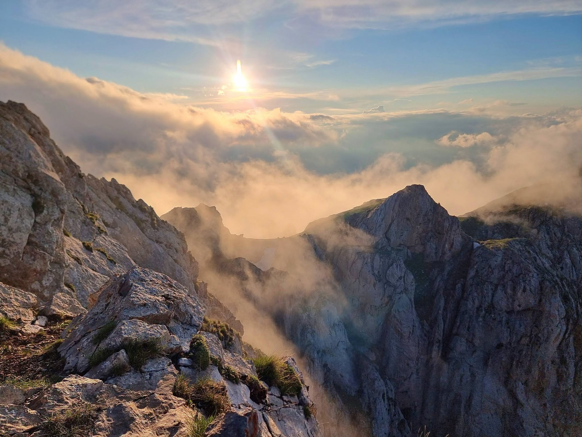
The Transcaucasian Trail stretches roughly 1,500km across Armenia and Georgia.
- Stages
- 4
The Transcaucasian Trail stretches roughly 1,500km across Armenia and Georgia. This article is the first 4 days of the trail.
Stage 1: 🥾 Day 1 of The Transcaucasian Trail
- Ascent
- 2000
- Distance
- 13
- Hours
- 11
If Day 1 is meant to be the hardest day on the Transcaucasian Trail, I have two words: thank fuck! 🥵
🐦 Wildlife Spotted: Small songbirds, countless butterflies, bees, and enough bugs to start their own country. Lizards scattered everywhere.
I started early knowing temperatures were forecast to hit 34°C. By 6.30am, walking through Meghri, it was already over 20°C. My pack felt ridiculously heavy, loaded with 4 litres of water 💧 and far too much food. Meghri is Armenia's southernmost town, tucked into a valley surrounded by mountains and sitting just a few kilometres from the Iranian border. 45mins of steep climbing through town brought me to the official start of the Transcaucasian Trail ✅️ Or at least where it was supposed to start.
No big sign. No trailhead. No welcome arch. No trail. No TCT marker even 🤔 For a trail they are trying to get on the map, this is poor form. Just straight up the deep valley.
The Transcaucasian Trail stretches roughly 1,500km across Armenia and Georgia. I'd been warned this first section from Meghri was one of the toughest 💪, with nearly 2,000m of climbing, scorching temperatures, and long stretches where the trail is more of a suggestion than an actual path.
The climb started immediately. Loose rock, gravel, and steep slopes led me towards the first saddle. Eventually I spotted my first TCT blaze, a simple red and white stripe painted on a rock 🥳 A few appeared, around the start. Then they disappeared again for the entire day. It really wouldn't be difficult for a person to mark with painted blazes and TCT coloured ribbon the path. As they don't have physical maps for the trail or proper trail notes either and only a gps file. Yet, that does come with some good information about camp and water spots as well as ruins and interesting facts 👌 Welcome to the TCT 🙄
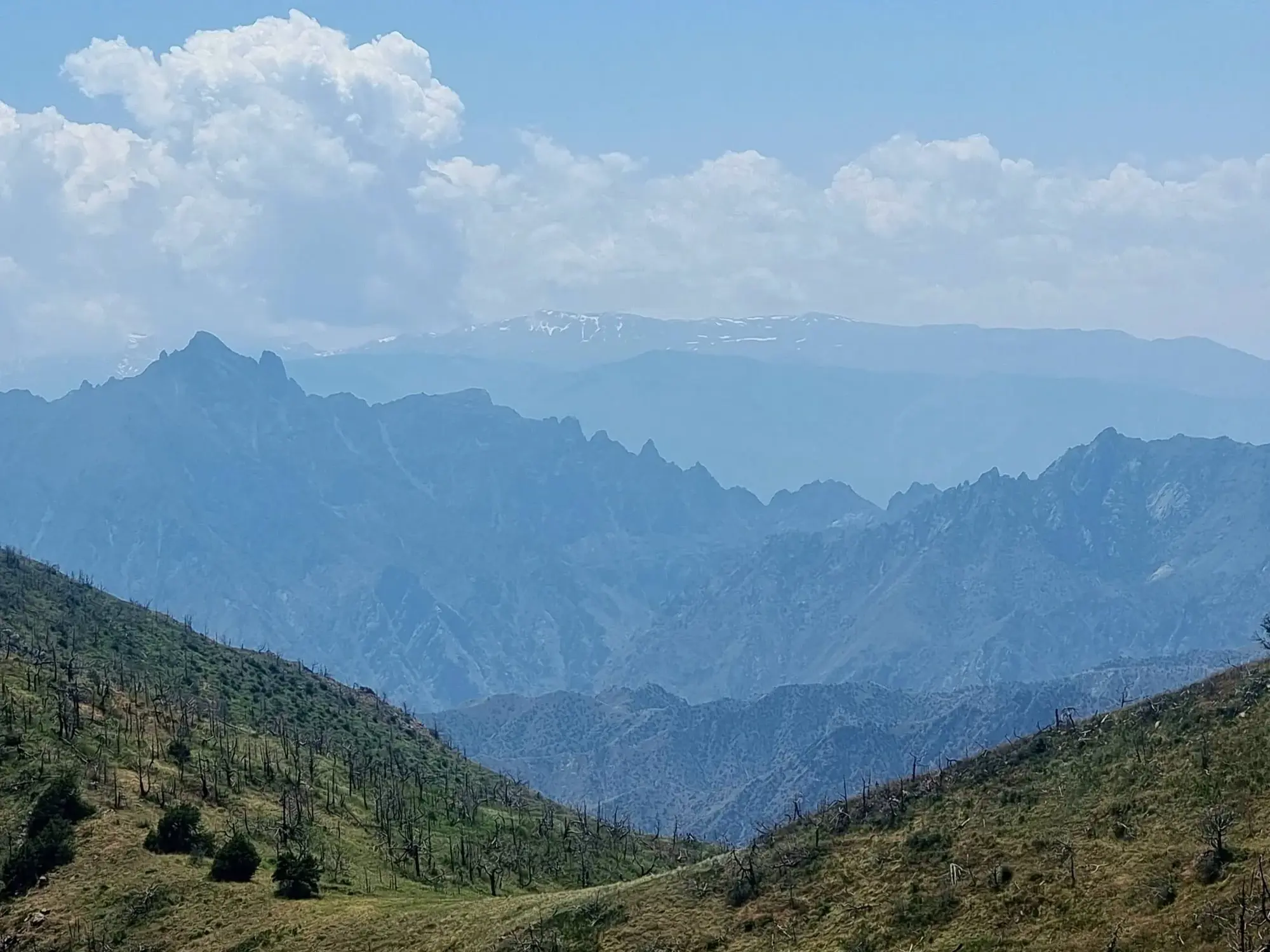
From the saddle, the views exploded in every direction. Jagged peaks, rolling green hills, dry rocky ridges, and mountain ranges stretching endlessly towards the horizon. The further I climbed, the more spectacular it became. The terrain was covered in summer wildflowers 🌻, butterflies drifted past on the breeze, and bees buzzed from flower to flower. The trail continued to climb and traverse across ridge after ridge. It was interesting the routes didn't actually take you to the ridgeline. You were constantly shy of it and walking on angles. A slight breeze helped, but by early afternoon the heat became relentless 🥵 Sweat poured off me. Shade was rare and every tree became a luxury rest stop 🌳 At one point I stretched out beneath one and accidentally upgraded my break into a full afternoon nap 😴 No regrets.
By mid afternoon I reached the turnoff for a spring. Leaving my pack behind, I followed an overgrown track for another kilometre. Finding a concrete water structure and pipe in the absolute middle of nowhere felt surreal 😯 Without GPS coordinates, most people would never find this.
The water was icy cold 💧By then I was down to my last 500mls. I drank it on the way to the spring and arrived running on fumes. I drenched myself in the cold water, filled my bottles, and drank like a camel that had just crossed the Sahara 🐪 Revived and refreshed, I headed back into the furnace 🌞 Somewhere along the way I completely lost the trail, wandered cross country for a while, and eventually stumbled back onto it. Then came the final climb to camp.
With temperatures at their daily peak and the trail disappearing into overgrown vegetation, the last few kilometres felt endless. Honestly, in Australia this wouldn't even be considered a track. It's mostly off track hiking with the occasional path appearing just long enough to give you false hope 🤣 Unless you enjoy having your eyes constantly on your gps 🫤 I was very grateful for years of off track hiking experience.
Finally, after one last brutal push, I reached 2,000m and a small grassy clearing beside the forest 🌲 Home for the night. Tent up ⛺️ Quick explore. Simple dinner. Then I completely crashed. As darkness settled over the mountains, the forest filled with birdsong 🐦 After such a savage day, falling asleep to that soundtrack felt pretty special.
One lesson was learned very quickly: shorts were a terrible idea. Day 1 drew blood 🩸and my skin allergies absolutely exploded. The plants out here seem to have formed a union whose sole purpose is attacking hikers. Everything is stinging, thorny, spiky, covered in spines, or all four at once. Grabbing vegetation for balance like I normally do is no longer an option unless I enjoy pain and regret. After today, Tasmania's scoparia feels like a friendly garden stroll. I never thought I'd say it, but I'll never complain about scoparia again.
The Slack TCT Group (where you can find a jumble of information about the TCT if you have the time to somehow sort it 😆) starting the Transcaucasian Trail from Meghri is the hardest section of the entire route. After today, I really hope they're right. Because if every day is like this, it's going to be one hell of an adventure 😵
-Lights Camera Adventure
Stage 2: Day 2 on The Transcaucasian Trail
- Hours
- 9
- Distance
- 13
- Ascent
- 800
Got drunk with Armenian hunters, fired a rifle, explored abandoned villages and pitchrd tent in an abandoned church. Day 2 got weird.
🐾 Song birds, feild mice, lizards, snake, wild horses, bugs and butterflies.
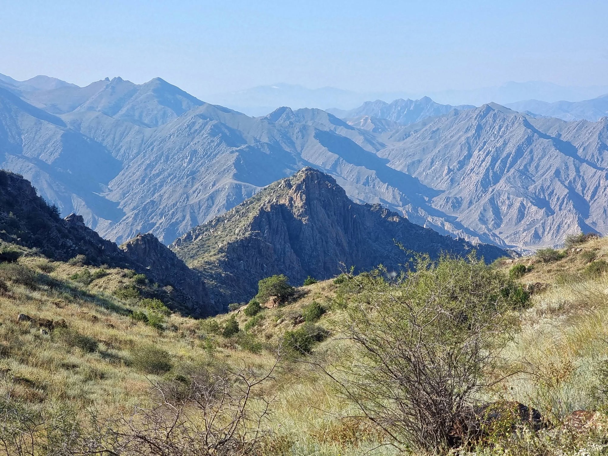
I woke to a cold mountain morning and clear blue skies. With the sun only just peeking over the ridgeline, I rolled over and stole a few more precious minutes of sleep before finally crawling out for breakfast 🥣 The trail continued along an exposed ridgeline and what a ridgeline it was. Views stretched forever in every direction. Massive mountains, endless valleys and enough perfect campsites ⛺️ tucked into the saddles to keep any wild camper happy, assuming the weather behaved. After yesterday's furnace like temperatures, the cooler conditions were a gift.
Then I reached a viewpoint that stopped me in my tracks. The scale of this place is hard to describe. Mountains upon mountains disappearing into the horizon 🏔 The kind of landscape that makes you feel wonderfully small.
Then things got very Armenian 🇦🇲 Two short wheelbase 4WDs appeared and six Armenian blokes waved me over 👋 Through a mix of broken Russian, hand gestures and laughter, I discovered they were gathering wild mountain plants, something that looked a lot like wild dill. They boiled it in salty water and ate the stalks alongside homemade schnapps 🥃 Naturally, they handed me one to try.
Naturally, they poured me a shot (it's like 6.30am). And naturally, it wasn't a shot. It was a Russian sized shot. Before I knew it, I was sitting on a mountain eating fresh cooked meat, potatoes, homegrown cucumbers and tomatoes, lavash bread and knocking back homemade schnaps and vodka with six Armenian hunters who thought Cunningham the Pig 🐷 was hilarious and my hiking poles impressive compared to their wooden sticks.
The shots kept coming. They showed me photos of the venomous snakes I should avoid on the trail. More shots. They told me none of them had ever heard of the Transcaucasian Trail.
More shots. Then one of them handed me a rifle and asked if I wanted a go 🔫 Well, it'd be rude not to 😉 After checking it was loaded and chambered, I lined up a rock 🪨 squeezed the trigger and sent it flying. The roar from the guys was nearly louder than the rifle itself. Apparently I still haven't forgotten how to shoot.
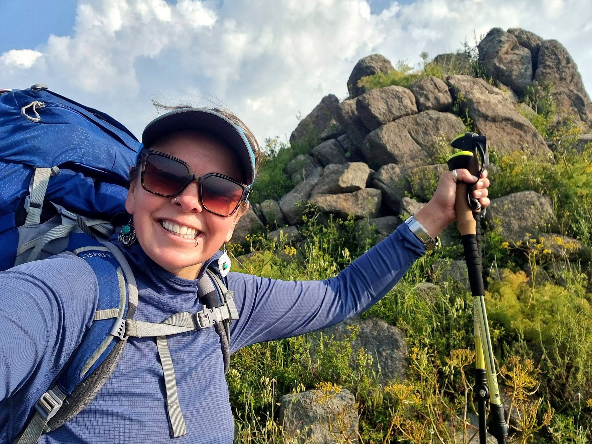
At that point I was fully accepted as one of the boys ✅️ It's something I've experienced often in life. Sometimes being a bit of a tomboy opens doors, earns respect and turns strangers into friends. It has also helped me navigate more than a few difficult situations over the years, where dangerous men became my mate. You want those kind in your corner 😉 After what I believe was seven shots of various homemade creations, I finally put my foot down. "No more. I still have to hike." 👩🦯 I handed out some Lights Camera Adventure stickers, received several shoulder slaps of approval and set off down the track.
Not long later the guys caught up in their 4WDs 🛻 and insisted on giving me a lift a couple of kilometres to the crossroads. Along the way we spotted a small herd of wild horses grazing on the mountainside. One of those unexpected moments that makes a day special 😯 Back on foot, I followed abandoned tracks through misty forests as grey clouds ☁️ rolled in overhead. At one point I accidentally followed what was probably an animal trail and ended up bush bashing through flattened grass before eventually relocating the real trail.
Then came a steep descent through wet, loose forest soil. I noticed plenty of skid marks left by the hiker before me. Soon I was adding my own. Whether it was the mud or the schnapps remains a topic of debate. But I could appreciate the fungi while I was down 🍄
-Lights Camera Adventure
Stage 3: Day 3 on the Transcaucasian Trail
- Hours
- 12
- Distance
- 18
- Ascent
- 800
If anyone tells you the Trans Caucasian Trail is just a long walk through the mountains, they're either lying or they've never hiked this section.
🐾 Song birds, bugs and butterflies, lizards, vipers and snakes, feild mice, weasels.
The day started with a free shower courtesy of Armenia's chest high wet grass. Within minutes I was soaked from the waist down and questioning what exactly qualifies as a "trail" out here 🤔 To be fair, calling this a trail is generous.
So far the TCT feels less like a maintained hiking route and more like someone found a collection of forgotten roads, animal tracks and old pathways that may have last seen regular use sometime during the Middle Ages, connected them with a GPS line and said, "Good luck." 🤣 Without the GPX track I'd be completely stuffed. There are virtually no markers out here (unless near a town or used road where someone has haphazardly painted the white and red stripes of the TCT blaze and you don't even need help there). No signs. No reassuring arrows. Just endless wilderness and a tiny blue dot telling me where I should probably be 🔵 After a short climb I reached the high point for the day before beginning what felt like an endless traverse across mountain ranges. The morning sun brought snakes sun baking along some of the gravel trail. 2 vipers seen leaving the ruined village of Abkes 🐍 Up, down, around ridges, across steep hillsides where your feet 🦶 ache from constantly walking sideways.
Then came the forests 🌲 Dense enough that you can't see where you're going and sometimes dense enough that you can't even see where the trail is supposed to be 🤣 Every creek crossing seemed guarded by hogweed, the lovely plant that strips away your skin's UV protection and can leave nasty burns if exposed to sunlight. Throw in plenty of stinging nettles and every water stop became a game of "what's going to get me first?" 😱 Yet, water hasn't been an issue since the 1st day and filtration for me, hasn't been needed. No signs of livestock and crystal clear cold water 💧
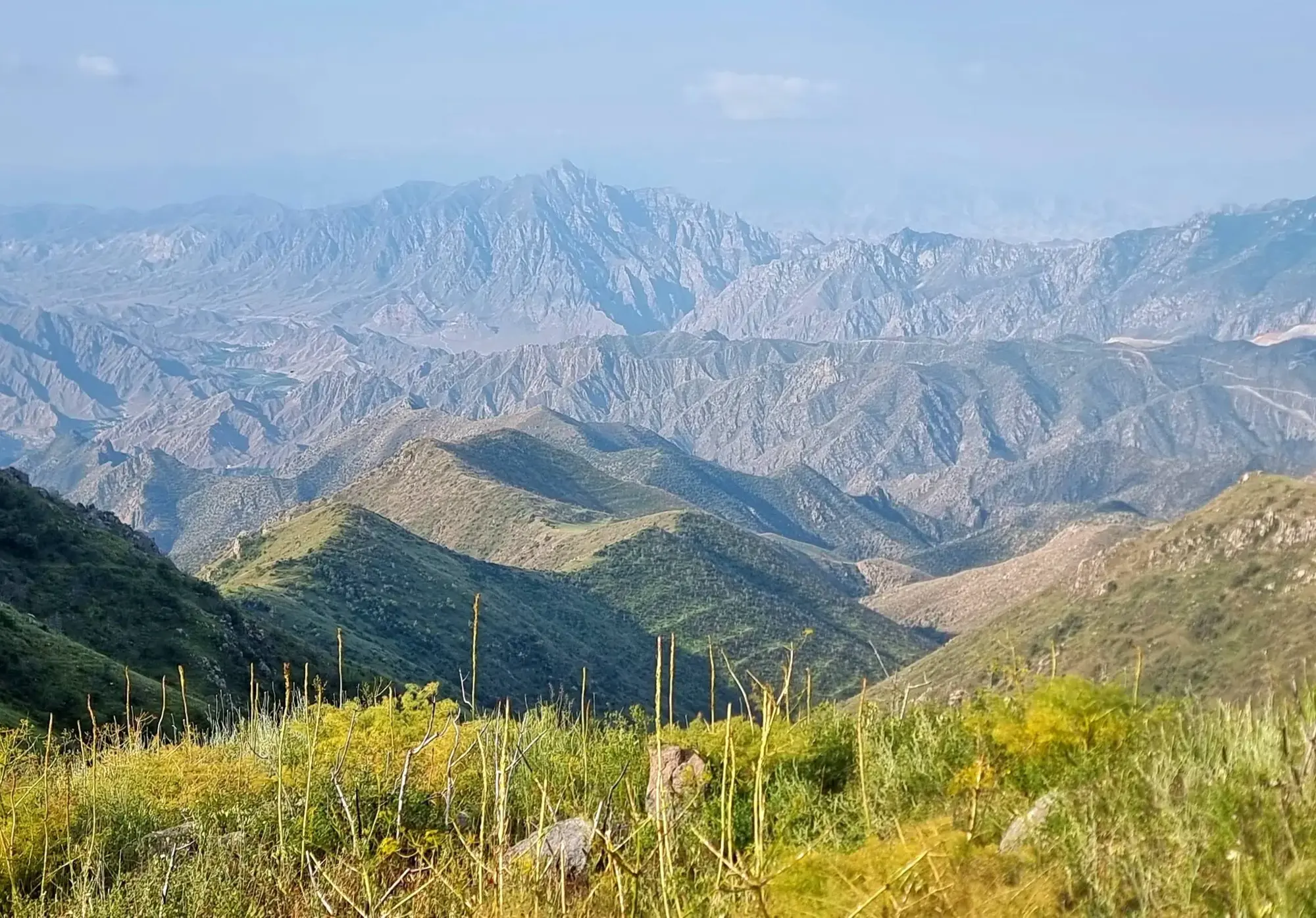
The views, when they appeared, were spectacular 😯 Massive valleys. Layer upon layer of mountains. Looking back and seeing just how far I'd travelled under my own steam gave me the boost of determination I needed to keep going 💪 The weather played games all day. Warm sunshine drained every ounce of energy from me, then cool misty clouds would roll across the valleys, turning everything into something straight out of a fantasy novel. One moment I was sweating, the next I was wandering through clouds.
-Lights Camera Adventure
Stage 4: 🏔️ DAY 4 on The Transcaucasian Trail
- Hours
- 6
- Distance
- 12
- Ascent
- 1800
If there was ever a day that proved suffering and reward are dance partners, this was it 😉
🐾 Birds, bugs and butterflies, lizards, feild mice, weasels, mountain goat, fox, wild horses.
I really didn't want to leave Khustup Mountain B&B. Warm bed. Warm shower. Good people. Then they went and made me a massive breakfast of sausages and eggs 🍳, so naturally I sat there for nearly an hour stuffing my face before finally dragging myself out the door.
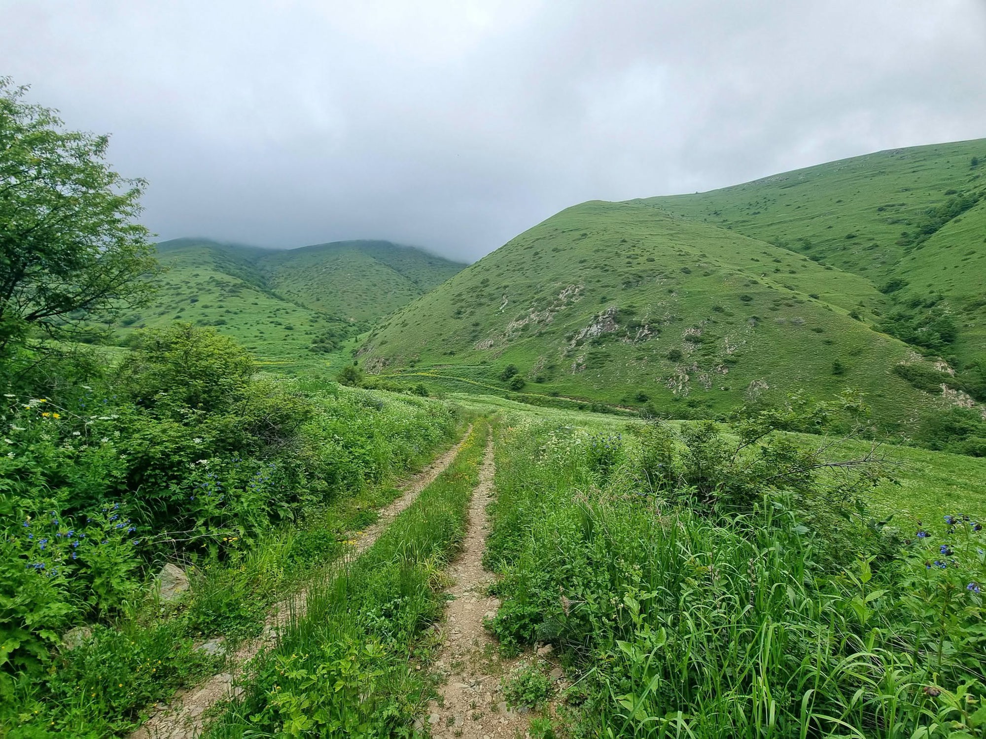
Today had one job. Go up. And then keep going up ⬆️ There were no gentle sections, no sneaky flat bits, no downhill rewards. Just relentless climbing. The sort of climbing where your calves start writing complaint letters. To make things more entertaining, I hadn't really looked at the day's elevation profile. Classic Irene planning 😬 So every time I thought I must be nearly there, the valley just kept on going.
Then came the river crossings. Shoes on. Shoes off. Shoes on 🥾 Shoes off 🦶 Repeat. As I climbed higher, the valleys below exploded with green. Rivers twisted through the landscape, snow still clinging to distant peaks while clouds drifted lazily across blue skies.
Wildlife was everywhere. Butterflies floated past. Lizards darted across the track. Tiny mice and weasels scattered through the grass. A fox vanished into a pile of boulders 🦊 Then my favourite. A mountain goat standing right in the middle of the 4WD track staring at me. I'm pretty sure it was thinking, "You know humans usually drive this bit, right?" 🤣 Fair point.
The higher I climbed, the thicker the mist became. Then the rain started. Not enough to stop me, just enough to remind me who was boss 🌧 Somewhere along the way I even found two snails enthusiastically making more snails. Nature really was putting on a show. Then I saw it. The high point! YES! 🥳 I had climbed nearly 1,400m and reached over 3,100m altitude. Suddenly it made sense why breathing had become optional. A few more steps...
-Lights Camera Adventure